
写的 - The Other Hat
1. This app is based on the United Kingdom Hydrographic Office's print publication "Chart 5011 (INT 1) EDITION 2" Admiralty Charts Publication and "Chart No.1 United States of America Nautical Chart Symbols, Abbreviations and Terms".
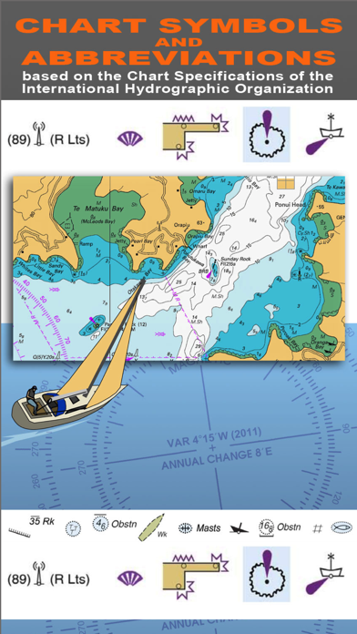
2. "CHART SYMBOLS & ABBREVIATIONS" provides quick reference to the "INT 1" symbols specified by the International Hydrographic Organization (IHO) for use on International marine charts.
3. SYMBOLS USED ON NAUTICAL CHARTS SPECIFIED BY THE INTERNATIONAL HYDROGRAPHIC ORGANIZATION (IHO), PLUS INTERNATIONAL ABBREVIATIONS AND SUPPLEMENTARY NATIONAL SYMBOLS USED BY THE U.S. AND U.K. HYDROGRAPHIC OFFICES.
4. SUPPLEMENTARY NATIONAL SYMBOLS Supplementary National Symbols for nautical charts used by the United States and United Kingdom are included at the end of each section.
5. NOTE: ECDIS symbols used to display Electronic Navigational Chart (ENC) data on Electronic Chart Display and Information Systems (ECDIS) as specified by the IHO are not included on this app.
6. A bonus section has tips on how to deal with emergencies including: Abandon ship; Dismasting; Distress Signals; Engine Failure; Fire Fighting; Flares; Getting a tow; Helicopter rescue; Holed hull; Man overboard; Medical emergency; Mayday; Panpan; Securité.
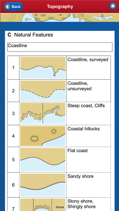
7. INDEX The index is an A-Z of symbols and abbreviations and enables the user to quickly look up the symbols and see them in context with others in the same categories.
8. INDEX & ABBREVIATIONS - international abbreviations and index to symbols and abbreviations.
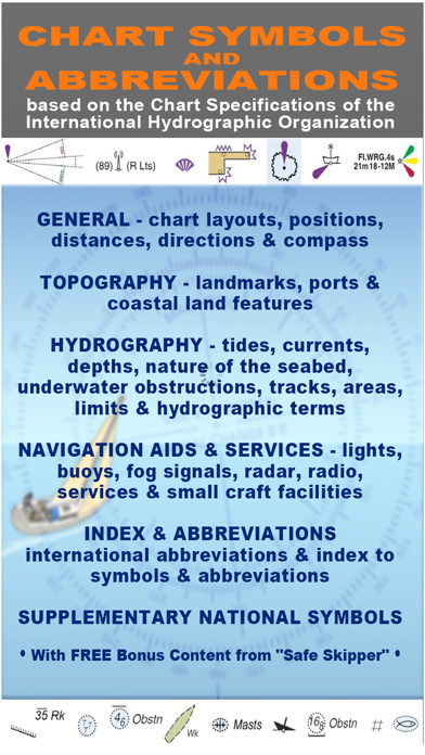
9. There are five main sections in this app, each with lettered sub-sections organized into categories to guide users through the hundreds of symbols.
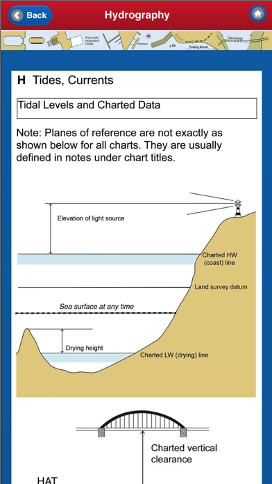
10. HYDROGRAPHY - tides, currents, depths, nature of the seabed, underwater obstructions, tracks, areas, limits and hydrographic terms.
11. We have an on-going program of marine navigation and boating safety apps, so please contact us with any ideas or features that you would like to see included.
| SN | 应用 | 下载 | 评论 | 开发人员 |
|---|---|---|---|---|
| 1. |  i-Boating: GPS Nautical / Marine Charts - offline sea, lake river navigation maps for fishing, sailing, boating, yachting, diving & cruising i-Boating: GPS Nautical / Marine Charts - offline sea, lake river navigation maps for fishing, sailing, boating, yachting, diving & cruising
|
下载 | 4/5 200 评论 4
|
Bist LLC |
| 2. |  Marine Navigation HD - USA - Lake Depth Maps - Offline Gps Nautical Charts for Fishing, Sailing, Boating, Yachting, Diving & Cruising Marine Navigation HD - USA - Lake Depth Maps - Offline Gps Nautical Charts for Fishing, Sailing, Boating, Yachting, Diving & Cruising
|
下载 | 2.6/5 13 评论 2.6
|
Bist LLC |
| 3. |  i-Boating: USA - GPS Nautical / Marine Charts - offline sea, lake river navigation maps for fishing, sailing, boating, yachting, diving & cruising i-Boating: USA - GPS Nautical / Marine Charts - offline sea, lake river navigation maps for fishing, sailing, boating, yachting, diving & cruising
|
下载 | 2.5/5 8 评论 2.5
|
Bist LLC |
最佳替代品: 检查兼容的 PC 应用程序或替代品
| 应用 | 下载 | 评分 | 开发人员 |
|---|---|---|---|
| nautical chart symbols abbreviations |
获取应用程序或替代品 | 0/5 0 评论 0 |
The Other Hat |
或按照以下指南在PC上使用 :
选择你的电脑版本:
如果你想安装和使用 NAUTICAL CHART SYMBOLS & ABBREVIATIONS 应用程序在您的PC或Mac上,您需要为您的计算机下载并安装桌面应用程序模拟器。我们一直在努力帮助您理解如何使用 app 为您的计算机在下面4个简单的步骤:
好的。首先要做的事情。如果您想在计算机上使用该应用程序,请先访问Mac商店或Windows 应用商店,然后搜索Bluestacks应用程序或 Nox 应用 。网络上的大多数教程都会推荐Bluestacks应用程序,我也可能会推荐它,因为如果您在计算机上使用 Bluestacks应用程序时遇到问题,您很可能很容易在网上找到解决方案。您可以在这里 下载Bluestacks Pc或Mac软件。
现在,打开已安装的模拟器应用程序并查找其搜索栏。一旦找到它,请键入 NAUTICAL CHART SYMBOLS & ABBREVIATIONS 在搜索栏并按搜索。点击 NAUTICAL CHART SYMBOLS & ABBREVIATIONS应用程序图标。一个 窗口 NAUTICAL CHART SYMBOLS & ABBREVIATIONS 在Play商店或应用程序商店将打开并且它将在您的模拟器应用程序中显示商店。现在,按下安装按钮并像在iPhone或Android设备上一样,您的应用程序将开始下载。现在我们都完成了。
你会看到一个名为“所有应用程序”的图标。
点击它,它会带你到一个包含所有已安装应用程序的页面。
你应该看到 图标。点击它并开始使用该应用程序。
奖励: 下载 NAUTICAL CHART SYMBOLS & ABBREVIATIONS 在iTunes上“
| 下载 | 开发人员 | 评分 | 分数 | 当前版本 | 成人排名 |
|---|---|---|---|---|---|
| ¥12.00 在iTunes上“ | The Other Hat | 0 | 0 | 3.0 | 4+ |
要在Windows 11上使用移动应用程序,您需要安装亚马逊应用商店。设置完成后,您将能够从精选目录中浏览和安装移动应用程序。如果您想在Windows 11上运行Android应用程序,本指南适合您。.


高德地图-高德打车,导航公交地铁出行

百度地图-打车更快更优惠,智能导航和公交地铁

全球高清街景地图

腾讯地图-路线规划,导航打车出行必备
车来了-精准实时公交地铁,公共出行助手

掌上公交-精准实时公交车地铁查询
北斗导航-北斗三号全球卫星导航系统

北斗找人-守护家人出行安全
Google 地图

e高速 - ETC网上营业厅

奥维地图

北京公交-官方出品

Earth-地球

全国违章查询-交通车辆违章查询助手

WiFi密码查看器-WiFi密码一键查看!
 PcMac China